McArthur-Burney Falls Memorial State Park Campground
McArthur-Burney Falls Memorial State Park Campground brings campers from far and wide to enjoy its unique surroundings.
McArthur-Burney Falls Memorial State Park
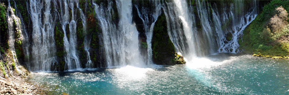
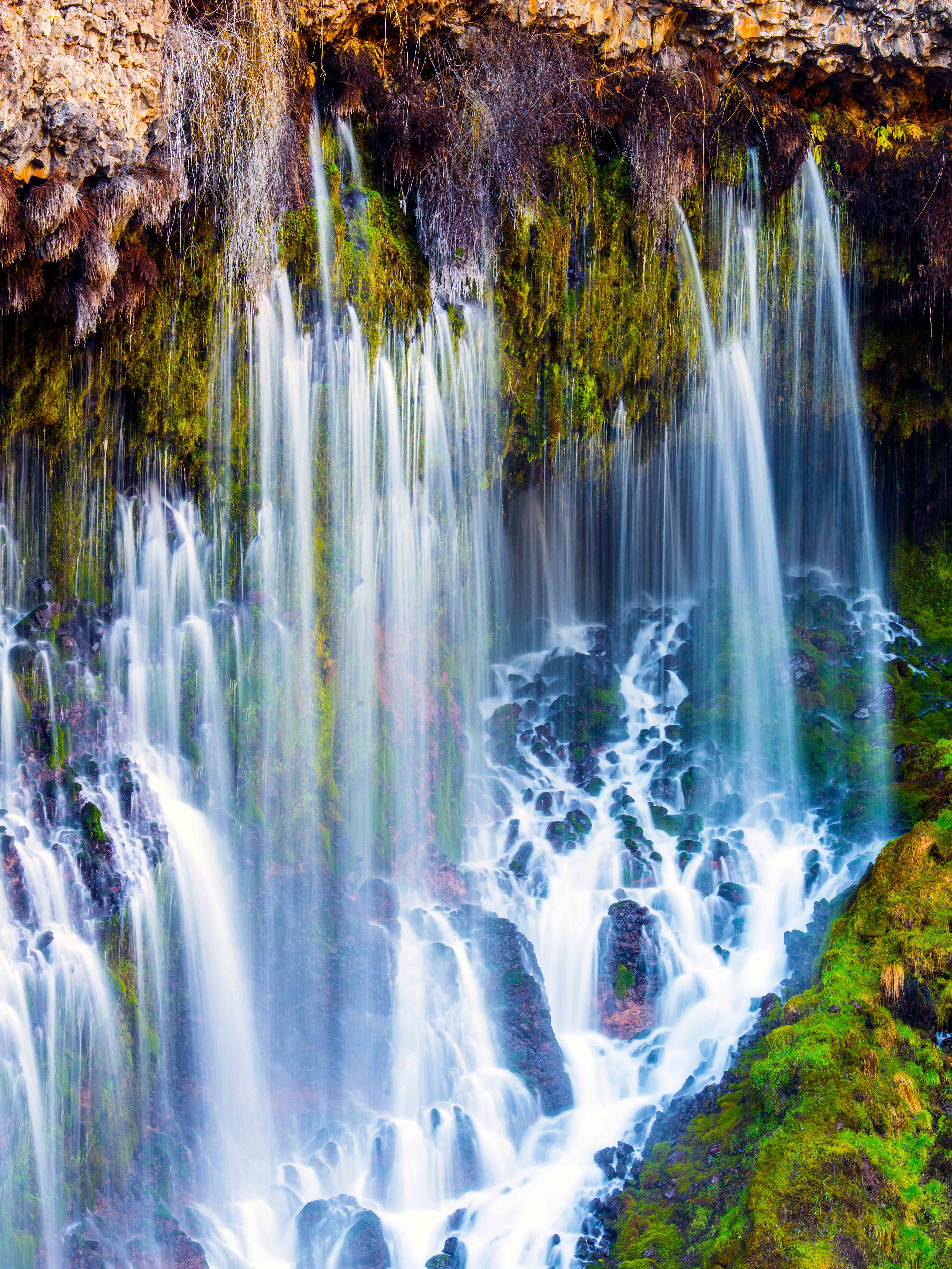
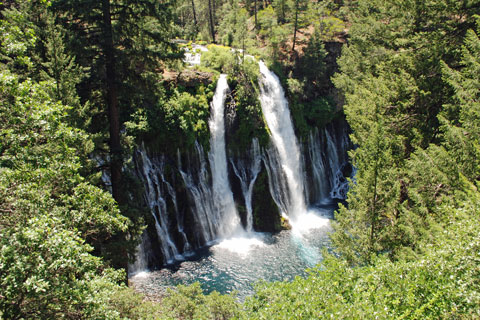
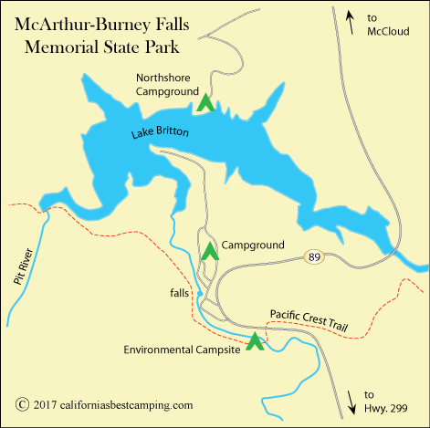
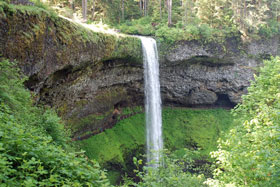
McArthur-Burney Falls Memorial State Park is in the Cascade Range, well-known for its history of volcanic activity. Sparkling Burney Falls is the park's main attraction. Currents from the Pit River spill 129-foot in a dazzling array of water cascading over volcanic rock. Many consider them among the most beautiful falls in California.
More Park Amenities and Attractions
◊ Visitor Center
◊ Camp Store and Food Services
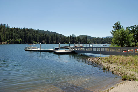
◊ 1,600-acre Lake Britton with marina, boat rentals, fishing, beach, and swimming
◊ 5 miles of hiking trails, connecting to the Pacific Crest Trail.
◊Some trails open to mountain bikes
McArthur-Burney Falls Memorial State Park Campground
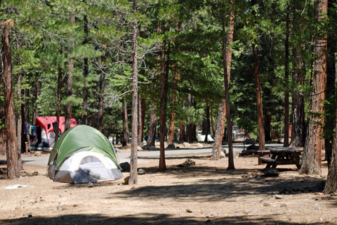
McArthur-Burney Falls Memorial State Park Campground has 128 campsites. Seventeen of the sites are designated for tents only while the rest can accommodate medium-size RVs, trailers, and tents. The main campground is divided into 2 side-by-side camping areas - Rim (sites 1-62) and Pioneer (sites 63 - 124). Both are within walking distance of the falls, the lake, and other park features.
Campground Amenities
◊ Picnic tables, fire rings with grills, food lockers
◊ Restrooms with flush toilets
◊ Showers
◊ Drinking water spigots
◊ Paved driveways
There is also a Hike & Bike campsite. In addition, about two dozen rustic one and two-bedroom cabins are available for rent.
Pacific Crest Trail
For more adventures, campers set out exploring hiking trails in the park, especially the famous Pacific Crest Trail. The 2,650-mile long Pacific Crest Trail passes through McArthur-Burney Falls Memorial State Park across Burney Creek from the campground. Hikers along the trail can opt for the Environmental campsite ($15 per site) found immediately after the PCT crosses Burney Creek or the Hike and Bike site ($5 per person) located on the northeast side of the main campground. (Use the PCT button to find information about the Pacific Crest Trail at McArthur-Burney Falls Park.)
Pacific Crest Trail Information
Take the Burney Falls trail junction to access the main campground and Hiker and Biker Campsite.
Trail Miles Northbound from Burney Falls trail junction
- Rock Creek bridge - 5.5 miles
- Screwdriver Creek - 9.6 miles + 0.1 mile off trail
- Deadman Creek - 19.8 miles
- McCloud River - 52 miles
- Canada Border - 1,233.5 miles
Trail Miles Southbound from Burney Falls trail junction
- Burney Mountain Guest Ranch - 7.7 miles + 0.3 mile southwest of trail. Hiker friendly
- small creek - 12.1 miles (possibly last water for 29 miles)
- Subway Cave - 41.5 miles
- Mexico Border - 1,416.5 miles
Nearest Town
Burney - 12 miles south via Hwy. 89 and Hwy. 299
Post Office, grocery, restaurants, lodging, Burney Sporting Goods, Burney Express (bus to Redding)
Always confirm mileages and directions with a reliable PCT source such as the Pacific Crest Trail Association's The Pacific Crest Trail: Exploring America's Wilderness Trail.


Reviews from Previous Campers
2024