Pacific Crest Trail Information
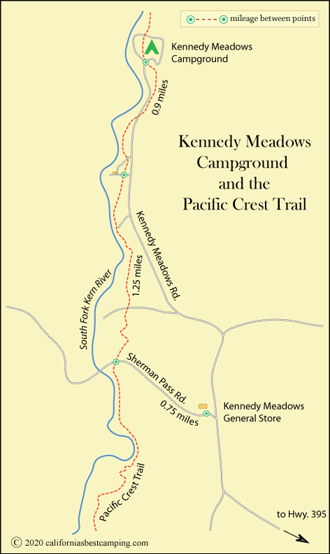
In the Kennedy Meadows community, hikers find a restaurant, internet cafe, and store. Also a grill, showers, and laundry. Resupply packages are accepted.
Trail Miles Northbound from Kennedy Meadows Campground
- S. Fork Kern River (wooden bridge) - 1.9 miles
- S. Fork Kern River (steel bridge) - 11.8 miles
- Mulkey Pass - 39.8 miles, trail junction to Cottonwood Pass Campground at Horseshoe Meadow, + 1.7 miles north of PCT
- Cottonwood Pass - 45.5 miles
- Canada Border - 1,945.3 miles
Trail Miles Southbound from Kennedy Meadows Campground
- Rockhouse Basin - 11.2 miles
- Chimney Creek - 23.9 miles
- Joshua Tree Spring - 40.5 miles
- Highway 178 - 52.7 miles
- Mexico Border - 704.7 miles
Nearest Town
Inyokern - 42.5 miles southeast of PCT off Highway 395
Groceries, restaurant, post office, Ace Hardware; in nearby Ridgecrest find Todd's Outdoor Supply
Always confirm mileages and directions with a reliable PCT source such as the Pacific Crest Trail Association's The Pacific Crest Trail: Exploring America's Wilderness Trail.


